Desert Online General Trading LLC
Dubai, United Arab Emirates
Desert Online General Trading LLC
Dubai, United Arab Emirates


🌟 Chart Your Course to Adventure!
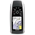
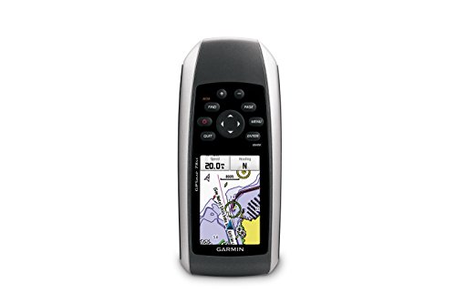
The Garmin GPSMAP 78sc is a waterproof marine GPS and chartplotter designed for boating enthusiasts. It features a high-sensitivity GPS receiver, a 2.6-inch color TFT display, and built-in BlueChart g2 coastal charts for the U.S. and Bahamas. With a rugged design that floats, a 20-hour battery life, and advanced navigation features, this device is perfect for any water sports adventure.

| Memory Storage Capacity | 1740 MB |
| Display Type | LCD |
| Human-Interface Input | Buttons |
| Compatible Devices | Aegean Sea & Sea of Marmara, Alborg-Amsterdam, Alpine Lakes, Bay of Biscay, Baykal & Novosibirskoe, Benelux Offshore & Inland, Canada, Caspian-Ulyanovsk-Orsk, Denmark East-Sweden Southeast, English Channel, Great Britain, Northeast Coast, Ireland, West Coast, Irish Sea, Italy, Adriatic Sea, Italy Southwest & Tunisia, Mediterranean Southeast, Portugal & Northwest Spain, Scotland, West Coast, S/E UK-Belux Inland Waters, Spain, Mediterranean Coast, Sweden Inland Waters, White Sea |
| Control Method | Voice |
| Are Batteries Included | Yes |
| Supported Satellite Navigation System | GPS |
| Sport Type | Boating |
| Battery Average Life | 20 Hours |
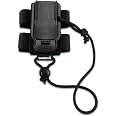
| Mount Type | Wrist Mount, found in image |
| Resolution | 160 x 240 |
| Compatible with Vehicle Type | Boat |
| Screen Size | 2.6 Inches |
| Additional Features | Rugged case, Barometric altimeter, Garmin Connect compatible, Electromagnetic compass, Garmin HotFix, Custom POIs, Automatic routing, Hunt/fish calendar, Geocaching, Photo navigation |
| Connectivity Technology | Bluetooth |
| Map Types | Oceania |
| Item Weight | 7.7 Ounces |
| Item Dimensions L x W x H | 2.6"L x 1.2"W x 6"H |
Trustpilot
1 day ago
5 days ago